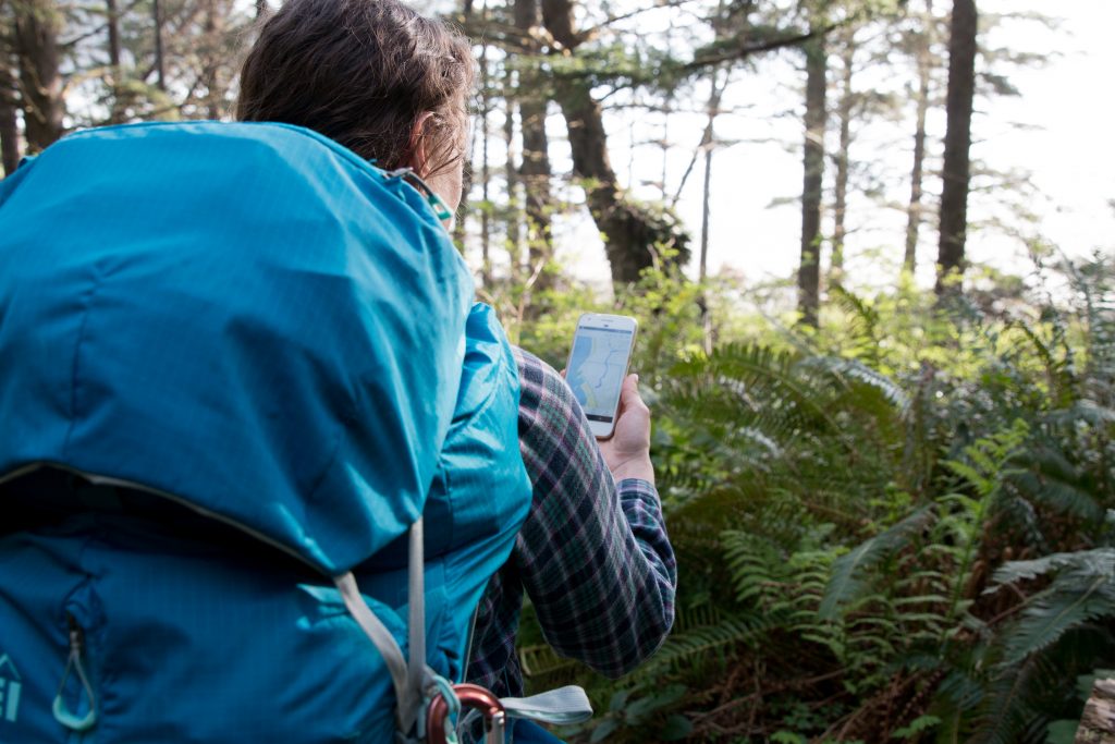
Nowadays mobile phone is one of the things that we almost always have in our pocket – also in the wild mountains. Modern phones provide many opportunities, and making phone calls has long ceased to be their main function. We spend more time using different apps. We asked our rescuers from Pip Ivan Mountain Rescue team and Mountain Volunteer Search and Rescue Bieszczady Group to share their favorite outdoor apps and tested them out. Here are the top fifteen useful hiking apps.
CALL FOR HELP
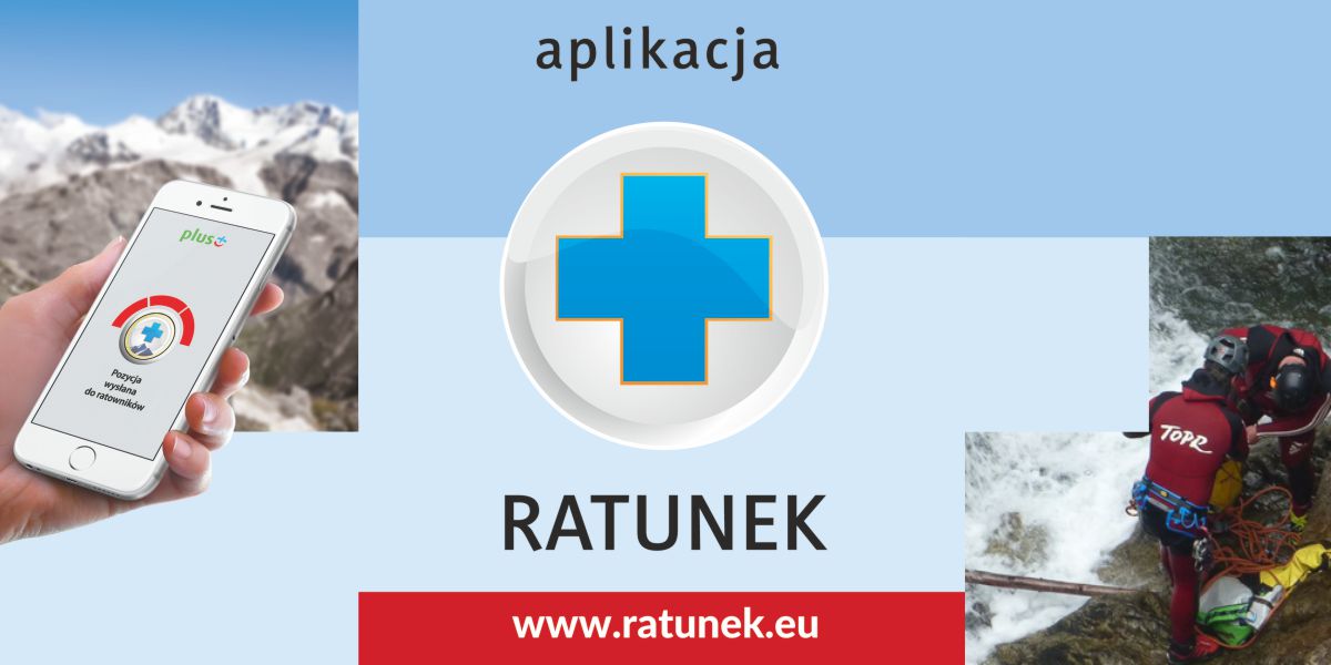
RATUNEK
RATUNEK (Rescue)is a Polish application that allows telephone contact with rescue services operating in Polish mountains (TOPR and GOPR) and by the water (WOPR and MOPR). In the mountains there are rescuers TOPR and GOPR and over the water – WOPR and MOPR.
The most important functions of the application:
– simple emergency call system. The app automatically connects the injured parties with relevant Emergency Service in Poland and dials the integrated emergency number in the mountains 601 100 300 or by the water 601 100 100;
– the app shows the location of a calling party. The application automatically sends information with the exact location (up to 3 m) of the injured parties. GPS coordinates are sent via text message during a phone call and make it possible to shorten the time of reaching a person in danger. Geolocation must be enabled on your phone to work properly.
The RATUNEK mobile app is the only approved and integrated emergency management system used by voluntary rescue services in Poland.
The RATUNEK app is free. Download on  and
and  .
.
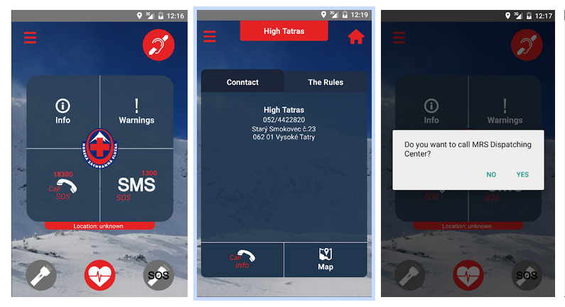
2. MOUNTAIN RESCUE SERVICE / GÓRSKIE POGOTOWIE RATUNKOWE
If you are going to visit the High Tatras of Slovakia it will be useful to have MOUNTAIN RESCUE SERVICE app. It operates on the same principle as the Polish application RATUNEK. Application allowing calls to be made to the emergency call number 18300 of Mountain Rescue Service and emergency SMSs sent, using the the current GPS position to quickly locate the injuret party in the mountain environment. It promotes communication for the deaf. Using the App, you get fresh information on avalanche danger and alerts in mountains in Slovakia. You get contacts, useful advice for movement in the alpine environment, and also a short guide on first aid administration. The App contains useful tools: a light and SOS light.
The App is free. Download on and .
TOURIST MAP /
LOCATION
3. MAPS.CZ
Mapy.cz by Sezna is a Czech mobile application with tourist maps. Its big advantage is use downloaded maps even just in the form of regions without internet access. The app allows you to plan routes on your device or PC.
Registration at Maps.cz, as well as the app download and maps are completely free. Download on and .
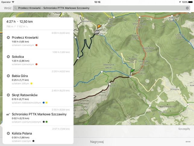
4. HIKING MAP POLAND / MAPA TURYSTYCZNA
HIKING MAP POLAND is one of the many available apps, which is quite popular among polish tourist. Hiking Map Poland helps you plan hiking routes and navigate the trail. The other advantage is the good quality of maps and the possibility of planning trials in Poland and Slovakia.
Premium users can use more detailed map layer with contours and terrain shading, which contains peaks, passes, parkings and other points of interest. It’s also possible to download maps of regions and use them offline.
There are free and Premium app’s versions. Free download on , while the price on is 25 PLN.
5. TRASEO
Traseo app is another mobile application with tourist maps with a strong focus on social networks. The app Traseo enables its users to share hiking trails and memories from trips with friends. Thanks to the app you may easily buy and download a chosen map of different cartographic editions which available also offline.
The app is free, while the maps should be purchased. Download on and .
6. В ПОХІД КАРПАТАМИ
As well as previous mobile application the В ПОХІД КАРПАТАМИ app is Ukrainian version of the map application. The important features:
– offline access the topo map;
– a great advantage is the free download of maps of some mountain regions of the Eastern Carpathians;
– available weather forecast.
The app is addressed to Ukrainian users, in Ukrainian language. Registration and the app download are free. Currently, it’s only available on .
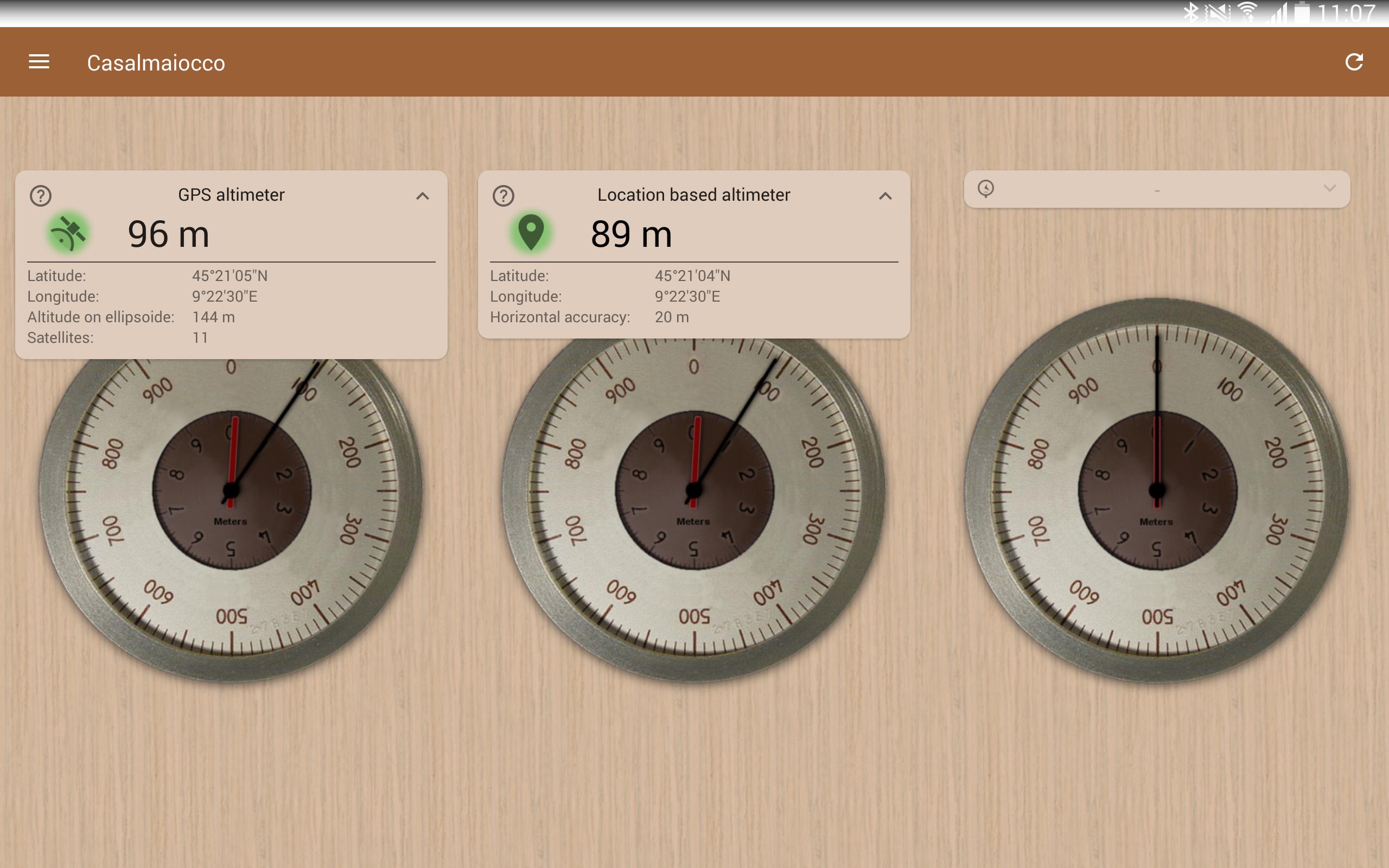
7. ACCURATE ALTIMETER
ACCURATE ALTIMETER app allows to get a reliable measure without internet connection. The app altitude estimation with three different methods, that’s why the accuracy of their information is up to few meters.
There are free and Premium versions. Download on .
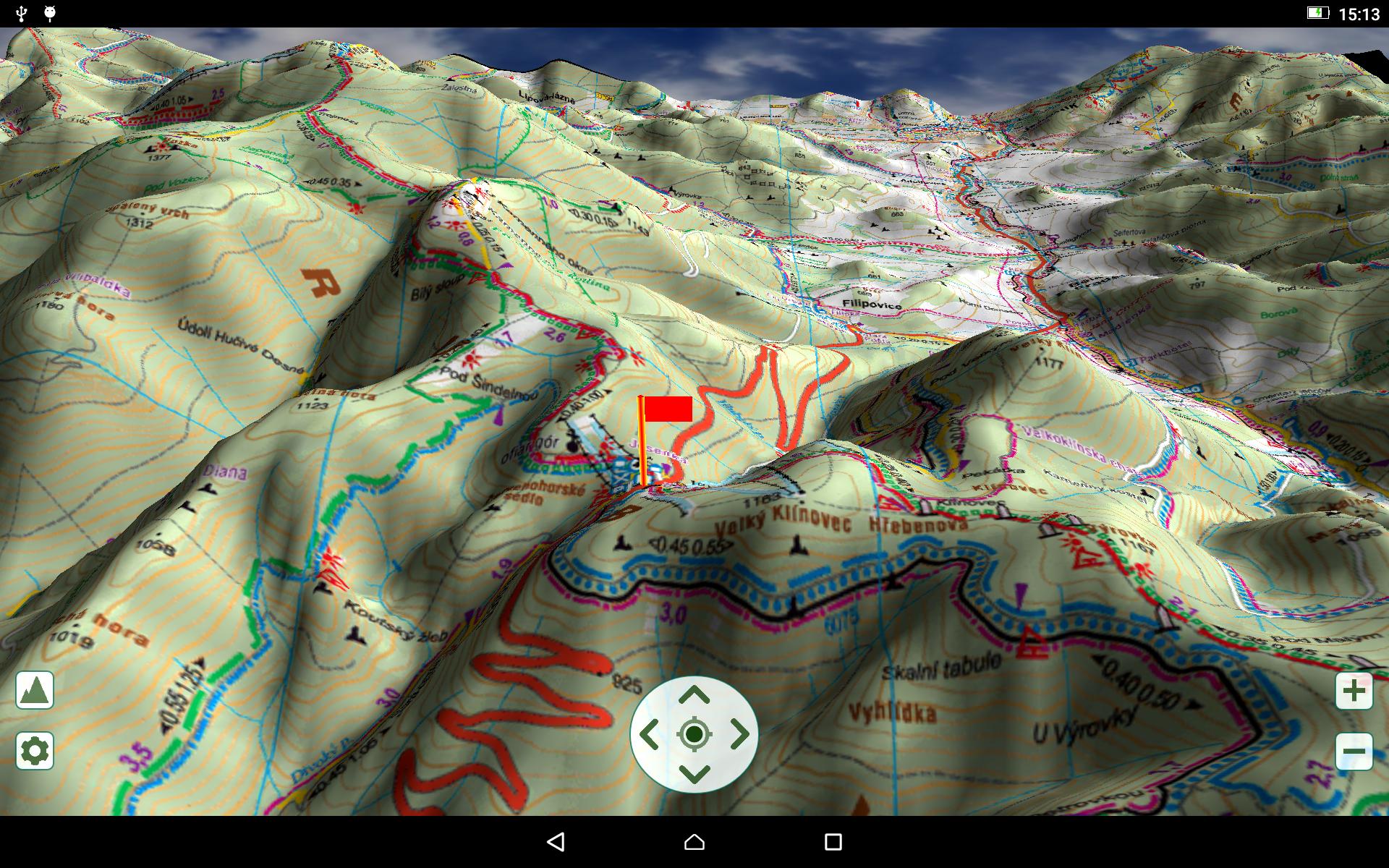
8. KaMAP
KaMAP apphelps you to discover trails to hike. The app shows your location in 3D maps. The costs of the maps are from 15 to 25 PLN. The app shows hiking, water and bicycle routes, viewpoints, altitude, roads, forest trails, reservoirs and shelters. These maps cover most mountains in Poland.
The app is free, while the maps should be purchased. Download on .
9. PEAKVISOR
Have you ever been out on a hike and wondered which epic peak was off in the distance? PeakVisor app uses your phone’s camera and state-of-the-art 3D technology to show you the names and elevations of 1,016,681 peaks around the world. You can also use this app to identify mountain huts and viewpoints, as well as hiking routes that can get you to some, but not all of, the peaks. You can input photos you’ve taken in years past to identify the peaks in your pictures, too. PeakVistor PRO lets you experience the same features and functionality offline.
Download on and .
WEATHER FORECAST
Strong wind, rainfall or storms are atmospheric phenomena that can easily change a pleasant mountain hike into a true fight for survival. Therefore, checking the weather forecast should be the first thing we do to plan cross-country treks and at the same time the last thing we do before hiking. It can therefore be said that the weather forecast app “must have” every mountain tourist.
10. YR.no
A very good weather service is also available in the mobile version is e.g. the Norwegian YR, which is known for its high accurate weather forecasts. The app is easy to use and transparent. The application is available in English, which may cause some difficulties for its users. YR app shows the weather forecasts not only for cities and mountain ranges, but also for selected peaks.
The app is free of charge and can be downloaded on and .
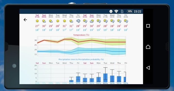
11. METEOBLUE
Location search with more than 6 million locations: search for location name, postal code or coordinates or let the app find your current position with the GPS module. The app provides standard parameters like temperature, precipitation and wind information, and unique features like predictability and cloud layers in different altitudes allowes a better forecast of precipitation probability.
Download free on and .
12. MONITOR BURZ / Poland Storms Monitor
MONITOR BURZ is a Polish app for tracking storms around the East-Central Europe. It shows lightning discharges and their displacement directly on the maps. This application is designed for users who know the Polish language.
The application is free. Download on .
OTHER
13. ENDOMONDO
The mobile app ENDOMONDO tracks your workouts using GPS. It can easily sync with other apps and devices to control, for example your heart rate. All your data is automatically synced with your profile on web page where you can view and analyze all your workouts and manage your account.
Free and PREMIUM version of the application is available. It can be downloaded on and .
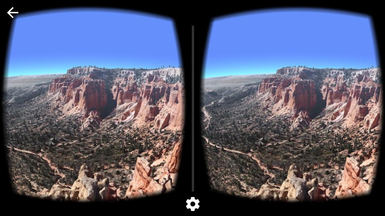
14. Aparat Cardboard
Aparat Cardboard is a free mobile application from Google that allows you to take panoramic photos. An additional app’s benefit is the ability to view photos in virtual reality with VR Cardboard glasses.
Free download on and .
15. STAR WALK 2
With Star Walk 2, you can identify the constellations above you when you’re on an evening hike or backpacking trip. You can discover celestial objects, see how they move across the sky and figure out where to look for any stars or planets you want to see. The latest version of the app offers a real-time map of the sky, 3D models of constellations, augmented reality and even a section for astronomical news. If you have kiddos, or just you’re astronomy lover, this is the app for you.
Free and PRO version of the application is available. It can be downloaded on and .
Using your phone in the wild
Finally, we would like to add that the using your smartphone in the mountains should be restricted. Frequent activation of the device and the use of different types of apps may cause quick battery discharge. Hence, in the situation when you will need your smartphone the most, i.e. to call for help, it’ll be impossible. If you often use the phone for taking photos, it is worth to buy an additional energy source – e.g. power bank. It must also be mentioned that the phone map apps should only have an auxiliary role, in the mountains you also need a paper map and a compass.
By Iurii Tkachuk